Anatomy of a Driftless parcel report
A complete technical breakdown of our 24-hour land intelligence delivery. We cross-reference karst features, slope constraints, and local zoning overlays to produce a clean, presentation-ready PDF.
Three core mapping layers
Our reports translate complex GIS shapefiles into a clean, presentation-ready PDF for your clients. Every report covers these three vital layers.
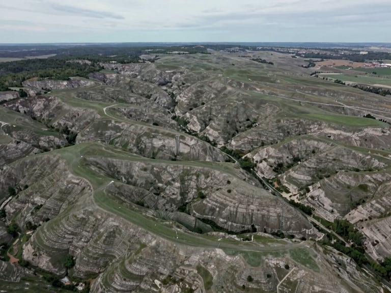
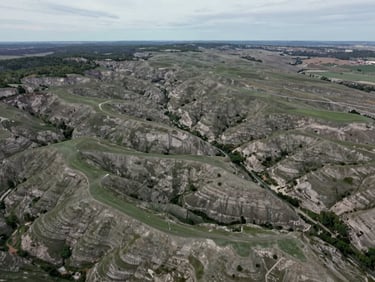
Karst & Soil Analysis
Slope & Elevation
Zoning & Easements
We locate sinkholes, losing streams, and shallow bedrock. Soil profiles detail load-bearing capacity and agricultural classification for the entire parcel.
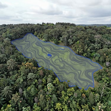
High-resolution LiDAR elevation data isolates buildable acreage from steep blufflands, ensuring grading feasibility and erosion control compliance.
We cross-reference county parcel splits, local setback rules, and utility easements to protect your transaction and speed up due diligence.
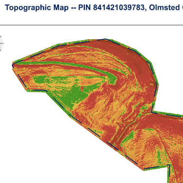
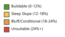
Inside the report pages
Actual page extracts from our standard PDF reports, detailing soil tables, slope maps, and karst hazard zones. Every chart is formatted for immediate client presentation.
Ready to verify your parcel?
Get your comprehensive parcel intelligence report delivered directly to your inbox within 24 hours. Enter your parcel ID to start.